Historic Trails & Emigrant History
This national significance is one reason the area has been designated as a National Historic Landmark.
THE PRIMARY MOUNTAIN GATEWAY OVER THE ROCKIES
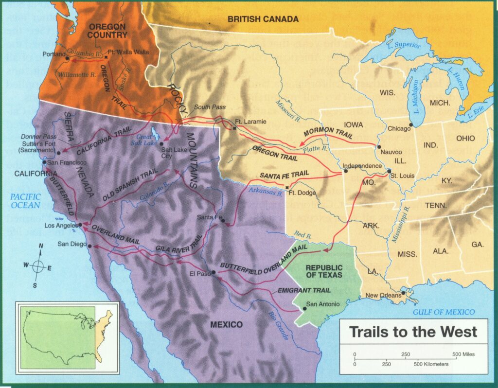
The Red Desert includes sections of the Oregon, California and Mormon Trails as well as the Pony Express mail route between the east and west coasts in the 1860s.
On the northern edge of the Red Desert lies South Pass. It was perhaps the most important landmark along the emigrant trails. It marked the end of the long ascent to the Continental Divide and the emigrants’ arrival at the frontier of the Oregon country. It was also thought to be the halfway point along the trail.
The pass served as the primary mountain gateway from the east to the west for hundreds of thousands of emigrants in the 1800s. As many as half a million people may have traveled this corridor in the 19th century. To many, the environments of the Great Plains, Rocky Mountains and Great Basin seemed like another planet, full of strange and alien landscapes.
Mountain men exploring the Rockies first set foot in the Red Desert in 1812, and except for a few roads and the loss of bison herds, the landscape looks very similar today to what it looked like then. The Red Desert is a focal point where many of the emigrant trails diverse. The Oregon, Mormon Pioneer and California trails all cross Wyoming in the central and most popular corridor of this migration. The trails followed the North Platte and Sweetwater rivers west to South Pass, after which they divided into various routes bound for Oregon, Utah or California.
Emigration routes were scouted by trappers, traders, the military and early pioneers in the 1810s-1840s. As the West was settled, destinations multiplied, necessitating a complex network of routes. Emigrants sought out alternative routes as the immense traffic on the main routes strained natural resources of the fragile steppes and desert. Isolated wagon tracks across the West quickly grew into a far-reaching capillary system.
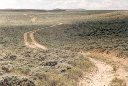
Today, visitors to the area can still see the network of rutted-out wagon trails from the thousands of settlers who traversed this landscape.
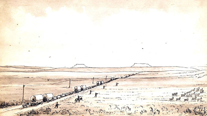
The Oregon Trail winds from South Pass toward Pacific Springs. Terry Del Bene photo.
The Oregon/Mormon Pioneer/California Trails have been studied and assessed according to the National Trails System Act of 1968 and have been designated as National Historic Trails. Designation as a National Historic Trail (NHT) is primarily an honorary distinction, providing little protection for any of the routes. However, this identification does expressly recognize the national significance of these routes and allows the federal government to assist with studying the resource and educating the public about these important places. The act further allows the federal government limited authority to acquire portions of these trails from willing sellers (info from Wyohistory.org).
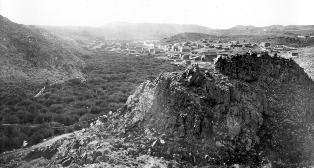
South Pass City and Atlantic City were booming mining towns in the 1870’s. In 1867 gold was discovered there, and miners stampeded in from all over the nation. Under this influx of population these two “cities” South Pass City and Atlantic City sprang up and were for a time lively, bustling towns. These twin cities, although hardy cities, are still inhabited today.
RED DESERT TRI-TERRITORY HISTORICAL MARKER
The Tri-Territory Historic Site in the Red Desert marks the spot where Mexico, the Louisiana Purchase, and the Oregon Territory intersected. It is hard to imagine anything ever happened at such an isolated location, but at this spot, three nations—Mexico, Great Britain, and the United States—met and competed for control of the North American continent. The Louisiana Purchase was bought from France in 1803, the Oregon Territory was obtained from Great Britain in 1846, and the Mexican Cession, which included what are now California, Arizona, Nevada, New Mexico and Utah and parts of Colorado and Wyoming, was obtained from Mexico in 1848.